| Park established | 12 November 1986 (plan announced); Taiwan’s fourth national park |
|---|---|
| Area | 92,000 hectares, spread over Hualien, Taichung and Nantou |
| Highest point | Nanhu Mountain, 3,742 m |
| April 2024 earthquake | 3 April 2024; roads and trails including Shakadang, Baiyang and Swallow Grotto were damaged and the park closed |
| Reopening | partial reopening of the Lushui area announced 3 February 2026 after more than 600 days of repairs |
Taroko in 2026: what’s open
The April 2024 earthquake near Hualien damaged roads and trails in Taroko National Park, and some of what’s described below is still closed. The park has been reopening section by section since then. As of October 2026:
The main road through the gorge, Provincial Highway 8, runs under traffic control between Tianxiang and the park entrance. Vehicles are let through in five set windows between 6:30 a.m. and 6 p.m., with extra control at works sites such as the Tunnel of Nine Turns. Over some public holidays the control is relaxed.
The Dekalun Trail is open. Swallow Grotto (Yanzikou) and the Eternal Spring Shrine are listed as closed by local sources. Reports on the Shakadang Trail and the Tunnel of Nine Turns differ, with some saying they’re closed and others that parts are open with limited, booked entry. Check the park’s official “roads and trails” notice before you go, and wear a helmet where the park requires one on rockfall sections.
Taroko is still worth the trip, but plan it with some flexibility: a night in Hualien rather than a rushed day trip from Taipei, and a local guide who checks the day’s status. Our Taiwan itinerary shows how it fits into 7, 10 or 14 days.
Sources (read in Chinese): Highway Bureau and Taiwanese press on Provincial Highway 8 traffic control (October 2026); local Hualien travel reports on trail status. Last checked October 2026.
About Taroko National Park
Taroko National Park is named for the Taroko Gorge, cut by the Liwu River through the marble of the Central Mountain Range. Chinese Wikipedia lists its sea cliffs and canyon among Taiwan’s eight scenic views and describes how the same park rises to alpine terrain, with 27 peaks counted among Taiwan’s 100 peaks. Visit early in the morning to avoid the crowds, and expect roads and trails to change with the weather.
The park lies in the homeland of the Truku (Taroko) people, who moved across the Central Mountain Range into the Liwu River and Mugua River valleys around the sixteenth century, according to Chinese Wikipedia. The name Taroko comes from their own name for themselves.
What to do in Taroko National Park
Much of the park is best explored on foot. The easy 4.4km Shakadang Trail, just a short walk from the Visitor’s Centre at the bottom of the gorge, follows a picturesque route alongside the Shakadang River. Other short trails, ranging from three to eight kilometres, branch off as you proceed up the gorge, including the beautiful Lushui Trail and Swallow Grotto Trail, but the most impressive walk is the Zhuiliu Old Trail, which includes a high suspension bridge crossing of the river. Permits are required to visit some parts of the park, and the unstable geology of the area means there is always a chance that the particular trail you want to walk is closed due to a landslide.
Besides the 18 kilometre, marble-walled Taroko Gorge, the park’s other not-to-be-missed natural attractions include the Tunnel of Nine Turns, Swallow Grotto, and the Eternal Spring Shrine which is dedicated to the 450 workers who lost their lives building the Central Cross-Island highway. Equally impressive is the Xiangde Temple, a Buddhist retreat that clings to the mountainside alongside a gushing waterfall, accessed by steps cut into the rock.
Getting off the trail in Taroko National Park
Travel from Taroko National Park to Sun Moon Lake across the Central Mountain Range, following Taiwan’s highest road, which reaches a lofty 3,200 metres on its way across the spine of the island. Banana palms and bamboo make way for pines, and then towards the summit, above the treeline, steep sided pastures and views are reminiscent of the Swiss Alps.
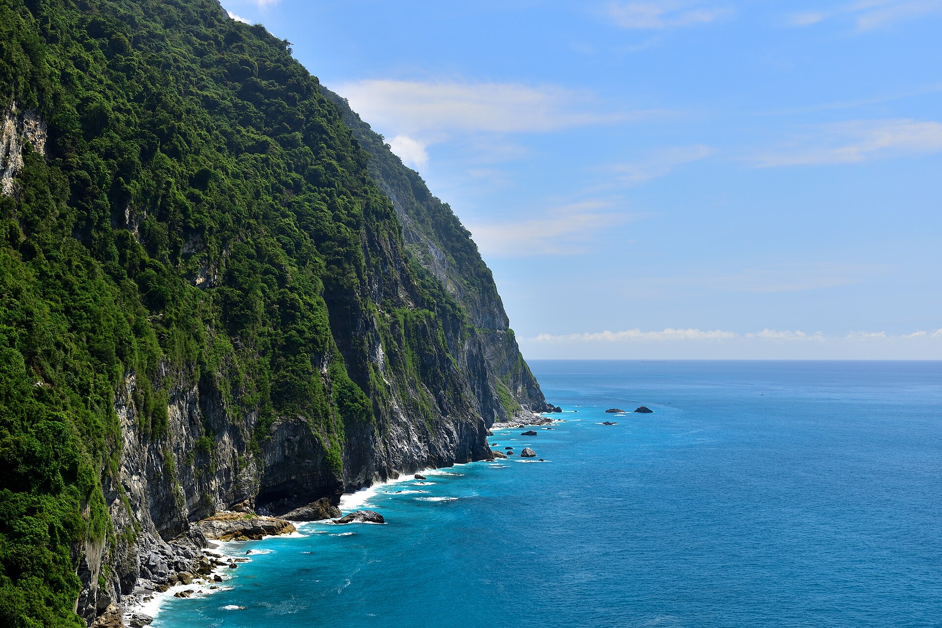
Taiwan’s eastern coastline is dominated by towering cliffs, and the most breath-taking example, the Qingshui Cliffs, are a short drive to the north east, still within the boundaries of Taroko National Park. Stretching for 21km from Chongde, the sheer cliffs rise up to 1,000 metres above sea level in places, and drop almost vertically into the turquoise waters of the Pacific Ocean.
90% of Taroko NP is mountainous, with 27 peaks over 3,000 metres
Wildlife spotting
The steep mountains around the gorge are a wildlife-spotter’s dream, although the terrain can be treacherous. Tread carefully, and silently, and you may well spot wild boar, bear, deer and the wide array of birds that make this spectacular National Park their home. Bird lovers take note that Taiwan has a large number of exotic endemic species that can be relatively easily spotted.
Feats of endurance
Taiwan is a cycle-obsessed nation and the country’s premier professional cycling event, the Tour de Taiwan, includes a stages in Taroko Gorge, while the King of the Mountains challenge, held twice a year, involves a total of 6,680 metres of climbing over 103 kilometres. Conditions can range from 35°C and 90% humidity at the start to a biting 5°C in freezing rain at the finish.
Photo: Huaiwun, Wikimedia Commons, CC BY-SA 4.0. Qingshui Cliff on the coast near Taroko.

How long to stay and how to plan around closures
Allow a night in Hualien rather than a day trip from Taipei, because transport and trail status can change at short notice. Chinese Wikipedia notes that the park closed after the April 2024 earthquake and again after a landslide dam formed on the Liwu River in October 2025, and that reopening has been gradual. In April 2026, the news agency CNA reported that recovery was continuing but that tourism was still waiting for confidence to return. Our Hualien page covers the base town.
Sources (read in Chinese, Chinese Wikipedia): 太魯閣國家公園, 花蓮縣. Last checked November 2026.
Taroko National Park: FAQ
Is Taroko National Park open?
Partly. The park closed after the April 2024 earthquake and has reopened gradually; a section of the Lushui area was announced open on 3 February 2026. Check the park’s official roads and trails notice before you go.
What is Taroko National Park known for?
Marble gorge and sea cliffs carved by the Liwu River, with mountains above 3,000 meters inside the same park.
How big is Taroko National Park?
About 92,000 hectares, mostly in Hualien County.
How many days do you need for Taroko?
One night in Hualien and a full day in the park, with flexibility for closures.
When did the park open?
The plan was announced on 12 November 1986. It is Taiwan’s fourth national park.